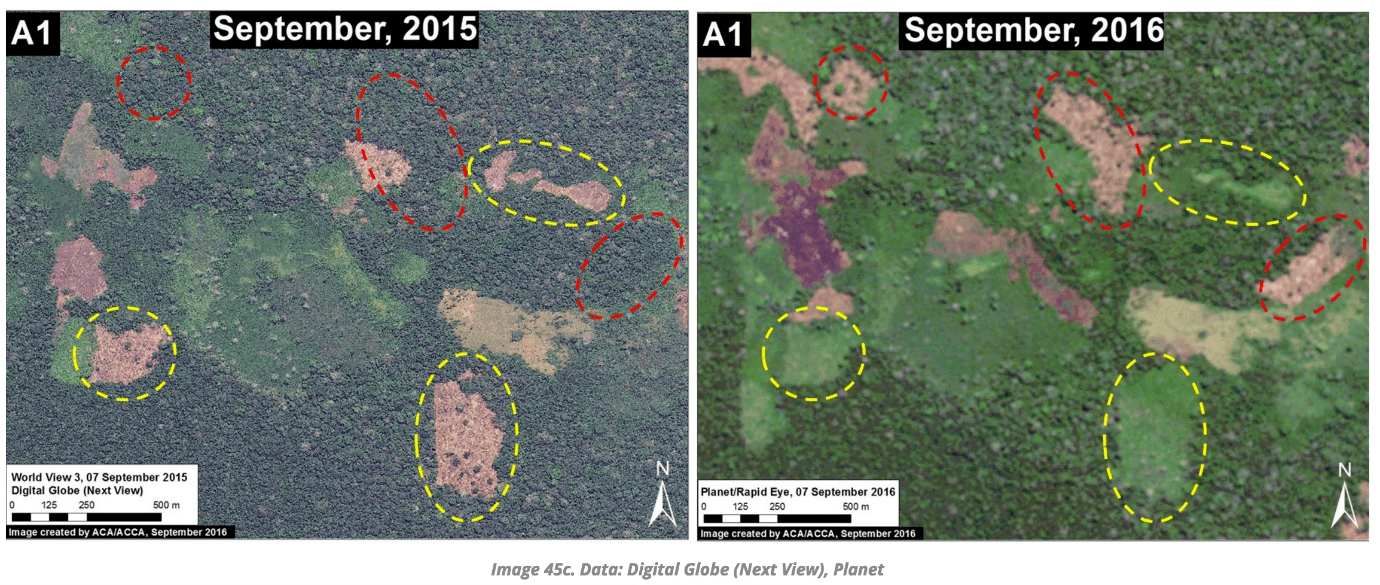
Examples of deforestation between September 2015 (left panel) and August/September 2016 (right panel).
Satellite analysis has identified “rapidly increasing”
deforestation due to agriculture and cattle ranching in protected indigenous
forests in Peru.
The El Sira Communal Reserve was established in 2001, to
conserve biodiversity for the benefit of the indigenous Ashaninka, Asheninka,
Yanesha and Shipibo-Conibo groups native to the area.
An “initial threat assessment” published this month found rising levels of deforestation driven by agriculture in the northern portion of the Reserve.
It estimated that 1,600 hectares of forest has been destroyed
since 2013, mostly in small-scale plots.
The analysis was carried out by the Monitoring of the Andean Amazon
Project (MAAP), which analyses and distributes satellite data to
improve understanding of patterns, hotspots and drivers of deforestation.
The Reserve lies in the central Peruvian Amazon, between the
Ucayali and Pachitea rivers. It encompasses a range of different landscapes, from
lowland tropical rainforests to the Cordillera El Sira mountain range.
Communal Reserves were established in Peru as a category of protected area with the primary objective of securing the rights and resources of indigenous peoples.
They have been regarded as an “innovative
tool” for management of vulnerable areas, but face the unresolved issue of
“a fundamental difference between conservation and indigenous perspectives of
the purpose of communal reserves”.
The case has been made that the model is preventing
indigenous groups from fully asserting their rights.
Click here to view MAAP’s analysis in full.


