An analysis of
satellite data by the Monitoring of the Andean Amazon Project (MAAP) has
revealed that cattle ranching is driving deforestation within the La Paya
National Park in the Colombian Amazon.
More than 1,200 hectares (ha) of forests were lost in 2016 to
2017 in and around La Paya. Deforestation in the region has increased since
2010, moving from surrounding areas into northern parts of the national park
and culminating in a peak of nearly 1,500ha cleared in 2014.
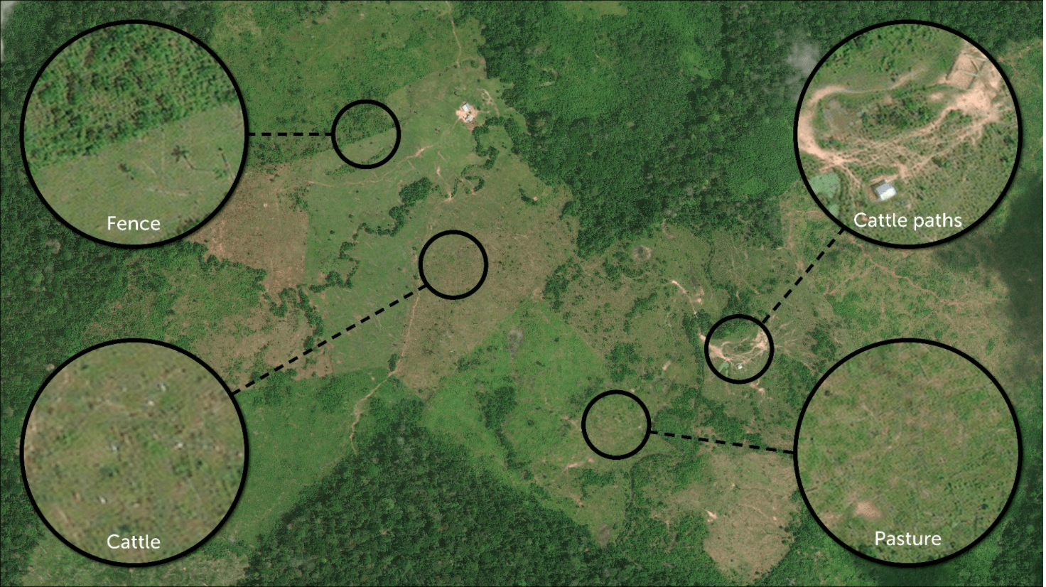
MAAP’s analysis indicates that deforestation within La Paya
is driven by cattle ranching. Cleared forests show large pasture areas,
fencing, worn cattle paths and even herds of cows.
The La Paya National Park sits along Colombia’s southern border
with Ecuador and Peru. According to Mongabay,
it is classified under the most stringent land protection category in
Colombia. The park is home to several Amazonian species, including manatees,
river dolphins, woolly monkeys and giant anteaters.
Mongabay has reported that
La Paya lost nearly 9,500ha of forests between 2001 and 2017. Of that,
1,420ha were lost from the park’s Intact Forest Landscapes (IFLs), which
are areas of primary and undisturbed forest.


